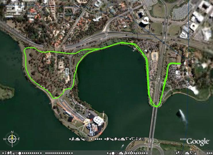
Customs Joggers Floriade Course

With the notices today that the usual start area for Customs Joggers Handicap will be fenced off from 5:00 pm, The course for next week and until the fences come down, will be as per the posted maps.
This is a map from the run on 17 September 2004.
Follow the bike path under Commonwealth Avenue Bridge, and then cross the road onto the path beside the lake.
Follow this path past the Ferry Terminal, and go under the tunnel up hospital hill, and down to turn left at the path near the lake.
Follow this path and turn left just before the museum.
Run up the psth and cross the road after the roundabout.
Follow the path until near the last willow tree. Join the track next to the lake and follow the usual track until just before the bridge. Follow that path all the way up the hill and it turns right about 300 metres before the finish.
Until Next Week.
posted by Friar at Friday, September 02, 2005
![]()
![]()

1 Comments:
good work with that map...
when you have the route open in GoogleEarth, right click on the route in the "Places" panel and select edit from the pop-up menu. Select the Advanced check box and you change the color in the Style Panel (click on the coloured box & the colour options appear)...pick your colour then save the route as normal...
Post a Comment
<< Home